

Newsroom
Deadly Data Management - the dos and don’ts
Brand new IMW Australia - On Demand course ‘Deadly Data’ will teach best practice when it comes to managing GIS data. In the lead up to the launch, we have shared our top tips on data management with you.

How can the Indigenous bush food industry benefit from mapping?
Find out how mapping technology can benefit the native bush food industry in Australia through introducing production systems and increasing the consumer market.

Three ways you can get digital qualifications from home
IT Services Coordinator, Tim Cable, is leveraging online learning platforms to further his digital industry knowledge. He has noted three key recommendations for anyone looking to broaden their skills using digital technology.

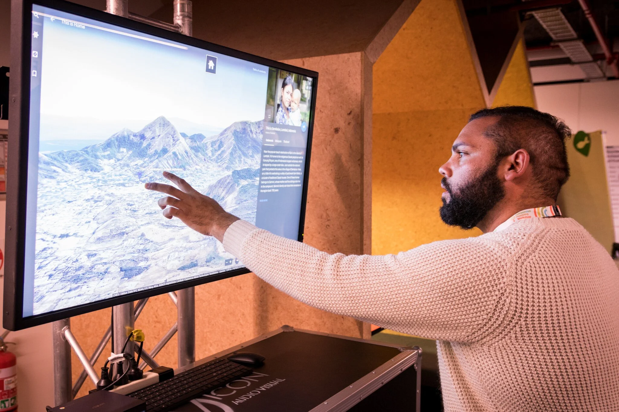
Podcast: Indigenous Mapping training available online
Listen to this episode of the Location Matters podcast to hear the strategy behind launching IMW Australia - On Demand.

Addressing digital inclusion in your RAP
Find out how you can address digital inclusion within your RAP with our Managing Director, Andrew Dowding.

#WhyIMap: Supporting the Indigenous Mapping Workshop
IMW Alumnus, Murrie Kemp, is the Aboriginal Place Names Officer at the Victorian Department of Environment, Land, Water and Planning (DELWP) and shares his #WhyIMap and IMW journey.

National Reconciliation Week: Telling Our Truth
In light of National Reconciliation Week, we sat down with GIS Analyst Merindah Bairnsfather-Scott to talk about what reconciliation means to her.

How can we close the digital divide?
As society becomes more reliant on digital technology, the divide between levels of digital inclusivity is increasing. How is this digital divide calculated and how can we overcome it?

#WhyIMap: Language conservation and the Indigenous Mapping Workshop
Founding Director of Miromaa Language and Technology Centre and IMW attendee, Daryn McKenny, shares his #WhyIMap journey.

#WhyIMap: Cultural connection at the Indigenous Mapping Workshop
Will Davis is a Senior Geographic Information Systems (GIS) Officer who participated in the Indigenous Mapping Workshop (IMW) in 2018 and 2019 as an attendee.
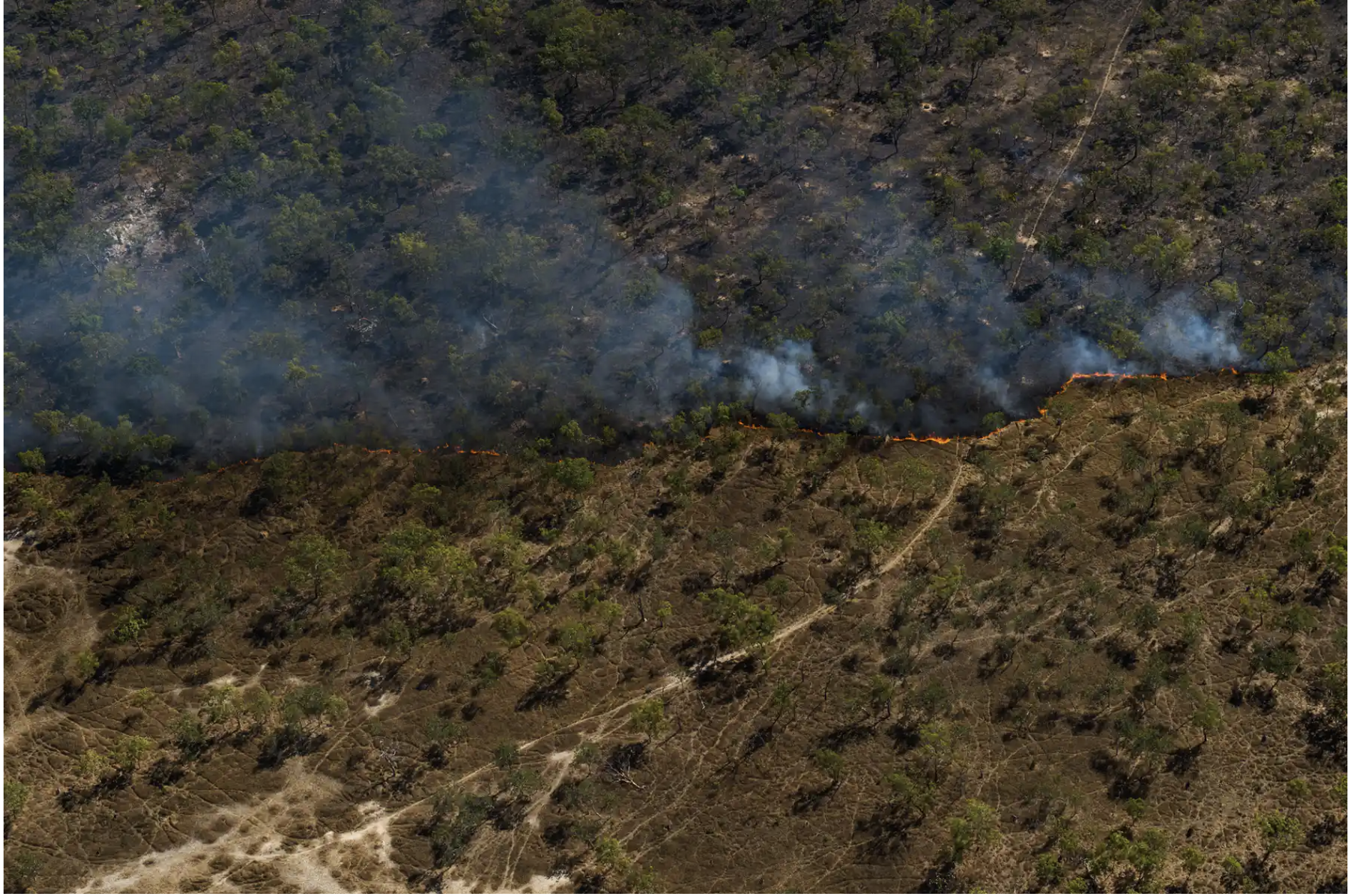
How to document Indigenous fire burning practices with maps
While Indigenous fire burning practices have come to the forefront of discussion, we caught up with 2019 IMW Fire Scar Mapping trainers Dion Fleming and James Keating to discuss what tools can help us document these practices.

Digital tools for local knowledge: The tourism industry of Pine Creek
The small town of Pine Creek has been empowering their Indigenous community members through the use of digital tools in tourism.

Ancient Aquaculture Sites in Budj Bim Cultural Landscape
Located on Gunditjmara Country within the Budj Bim Cultural Landscape, ancient eel traps that were engineered by Indigenous Australians thousands of years ago have recently been gaining national attention.

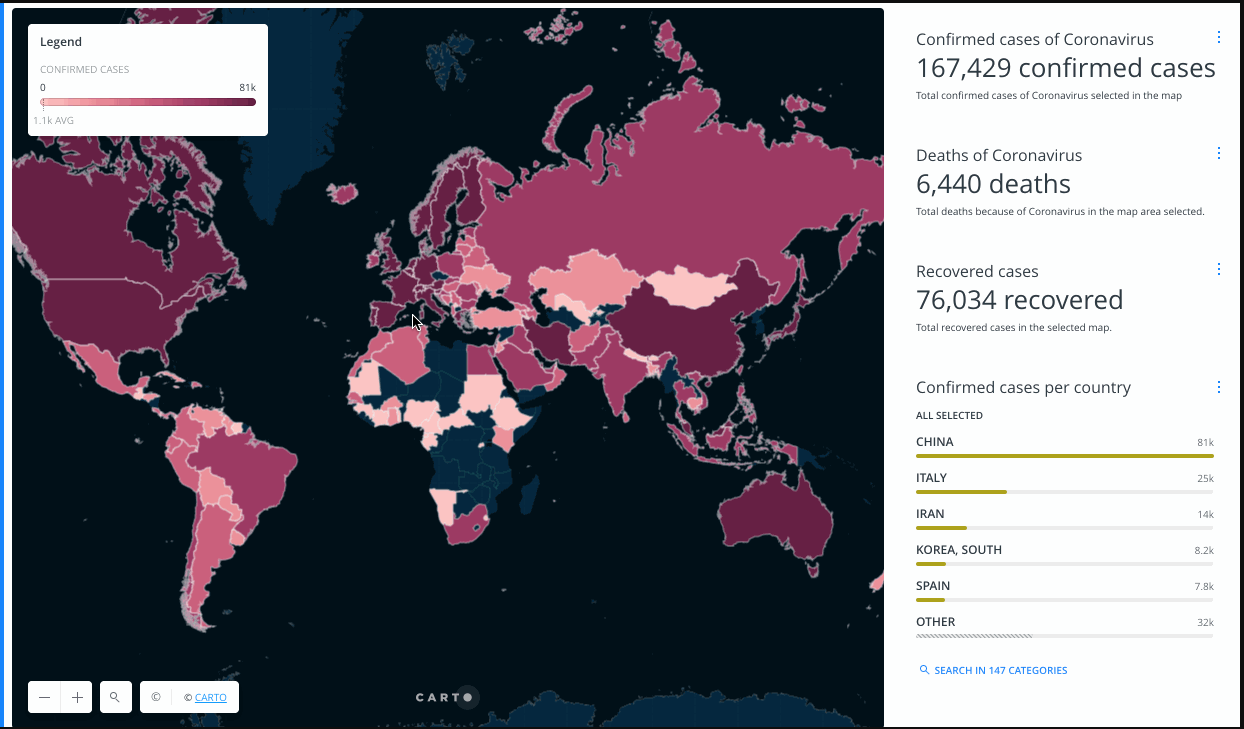
Why you need to know about Indigenous Data Sovereignty
What is Indigenous Data Sovereignty and why is it so important in the midst of COVID-19?
Winyama #COVID-19 Update
Winyama’s priority is to protect the health of our people, clients, families and community. Learn more about how our operations may change during this time.

#WhyIMap: Volunteering at the Indigenous Mapping Workshop
GIS student and volunteer Amy Kempton shares her #WhyIMap story and her volunteering experience at the Indigenous Mapping Workshop.

#WhyIMap: Growth within the Indigenous Mapping Workshop
GIS Analyst Merindah Bairnsfather-Scott shares her #WhyIMap story as the first of a five part series leading up to the Indigenous Mapping Workshop.

IMW Scholarship: Willowra Community
Willowra Community received a scholarship at the 2019 Indigenous Mapping Workshop. Petronella Vaarzon-Morel spoke with us about their mapping project.

IMW Scholarship: Kullilli Bulloo River Aboriginal Corporation RNTBC
The Kullilli Bulloo River Aboriginal Corporation RNTBC was one of three organisations to receive a scholarship at the Indigenous Mapping Workshop (IMW).
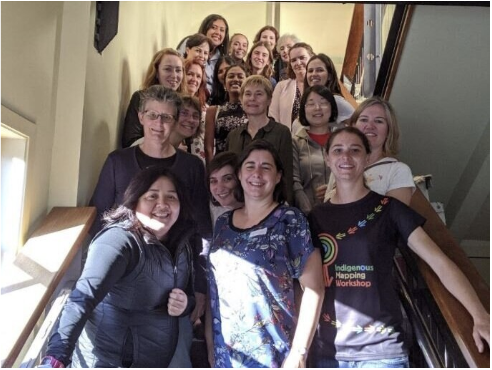
FOSS4G SotM Oceania attendees descend on Wellington
This year, Winyama’s GIS analyst Merindah Bairnsfather-Scott attended FOSS4G representing both Winyama and the Indigenous Mapping Workshop.